Early Explorers: The Portuguese
Did you know...
Two Portuguese sailors are well known for their early explorations: Bartholomew Diaz rounded the Cape of Good Hope, Africa’s southern tip, in 1488, and Vasco da Gama sailed around Africa and on to India in 1498.
When the Ottoman Empire blocked overland trade routes in the early 1400s, the Portuguese decided to explore a sea route around Africa to reach India and China to acquire the spices and luxury goods from the East that they had enjoyed. The Portuguese saw a potential for tremendous profits if they could bring the goods to Europe by ship. View the following map to see the routes traveled by early Portuguese explorers.
But there were two main problems:
- No one had ever attempted to sail to India or China from Europe
- Naval technology needed to improve before long oceanic voyages were possible
Did you know...

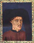
Prince Henry the Navigator
Prince Henry, born Dom Henrique, was called “The Navigator” by the English, although he never sailed on any voyages of exploration.
One wealthy Portuguese visionary, Prince Henry, sponsored numerous voyages of discovery along the western coast of Africa to add to geographic knowledge, find a sea route to the Orient, and perhaps, find gold. Henry supported cartographers who compiled the information brought back by sailors and his home became a mecca for instrument makers, craftsmen, and mapmakers who improved upon and learned from each others’ work.
One of the problems that Portuguese mariners overcame involved the design of ships. Traditionally-built ships were too heavy and slow for long distance travel but a new style of ship called the caravel was created by Portuguese shipbuilders that was lightweight, had a shallow draft so that the ship could explore up rivers, and had a large cargo to hold supplies for long voyages. Caravels also had triangular sails that added to the ships’ maneuverability.

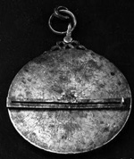
Astrolabe: 13th century. Held at the Adler Planetarium, Chicago, IL
During the same period, mariners and instrument makers improved the astrolabe and the magnetic compass so that they could be used on a ship. They developed a system to measure a ship's speed at sea that used knots tied in a rope and a weight on the end, hence the term "knots" is used to measure velocity today. Sailors measured how long it took for the knots to go over the edge of the ship into the sea. Knowing how fast they were going and in which direction allowed them to change the way maps were drawn so that they were more accurate. Improvements in navigation and technology allowed the Portuguese to explore further along the coast of Africa, but it was a slow process because each ship would go only a little further than the previous ship before returning home with new information for cartographers to use to update maps.